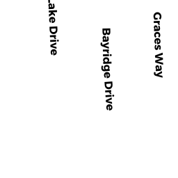
133 BAY RIDGE DRIVE SD
Owner Information
GORMLEY MICHAEL J ET UX
133 BAY RIDGE DRIVE
SOUTH DENNIS, MA 02660


Property Details
133 BAY RIDGE DRIVE SD is classified as a Single Family Residential (Ranch).
The primary structure on this property was built in 1962. There are 1,402ft2 of built area within this property. There is 1,402ft2 of residential/living space within this property. This property is listed as having 5 rooms.
133 BAY RIDGE DRIVE SD is valued at $464,700. The land is valued at $117,600 and the structures are valued at $344,900. There is an additional valuation of $2,200 on this property.
The most recent deed for 133 BAY RIDGE DRIVE SD is recorded at the local registrar in Book 31087, Page 297. 133 BAY RIDGE DRIVE SD was last sold on Friday, February 16, 2018 for $0.
Assessment data from fiscal year 2022.
Flood Data
According to the FEMA National Flood Hazard Layer, this property does not appear to be in a flood zone. It may also be in an area not yet reviewed. Nonetheless, confirm this information prior to taking any action.
To view the flood hazards around this property, create a FEMA "Firmette" Map of the area around 133 BAY RIDGE DRIVE SD.
Broadband Internet Providers
| Provider | Type | Bandwidth (mbps) | |
|---|---|---|---|
| Verizon New England Inc. | DSL | 5 | 0 |
| Viasat Inc | Satellite | 35 | 3 |
| Comcast | Cable | 1000 | 35 |
| VSAT Systems, LLC. | Satellite | 2 | 1 |
| HughesNet | Satellite | 25 | 3 |
| GCI Communication Corp. | Satellite | 0 | 0 |
Broadband service provider data from December 2020.
Adjacent Properties
- 123 BAY RIDGE DRIVE SD
Single Family Residential owned by STOLARIK RICHARD G ET UX - 24 LAKE DRIVE SD
Single Family Residential owned by DINOIA LAWRENCE F TRUSTEE - 28 LAKE DRIVE SD
Single Family Residential owned by PERRAULT DENISE A ET ALI - 32 LAKE DRIVE SD
Single Family Residential owned by GLEASON MARK E TRUSTEE - 139 BAY RIDGE DRIVE SD
Single Family Residential owned by PANASCI CAROL A